WASHINGTON COUNTY HISTORICAL SOCIETY (Washington County, Utah)
SHUNESBURG, UTAH
(aka Shonesburg)
LOCATION
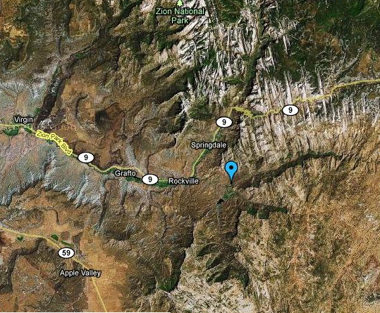
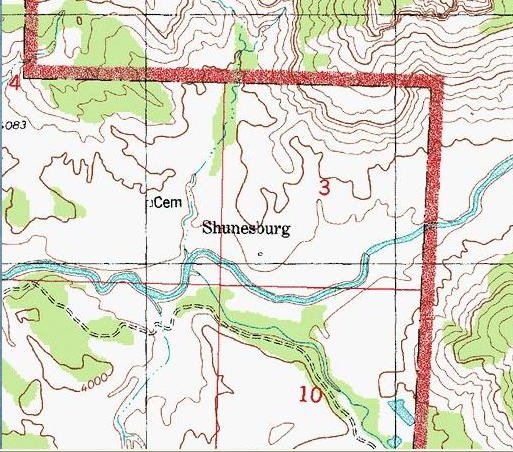
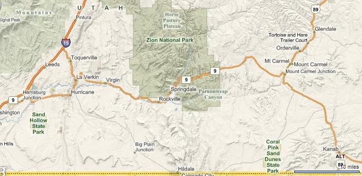
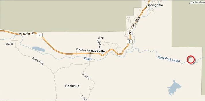
Shunesburg is situated on the current boundary of Zion National Park, on the south (or southeast) fork of the Virgin River (aka Rio Virgin) at the mouth of Parunumeap Canyon in Washington County, Utah.37.16666° North Latitude, 112.95° West Longitude
37.15812° North Latitude, 112.97766° West Longitude
37.15806° North Latitude, 112.97694° West Longitude
37° 9' 29" North Latitude, 112° 58' 37" West Longitude
Elevation: 3,979 feet (1,121 meters)
|
|
HISTORY
In the fall of 1861, Brigham Young called a group of people to leave Sanpete County and go to settle in southern Utah. This group consisted of Oliver DeMille, George Petty, Hyrum Stevens, Alma Millet Sr., Hardin Whitlock, Charles Clapper, and their wives and children. Oliver DeMille purchased some land along a small creek from an old Paiute Indian chief named Shunes (or Shones). A town site was laid out and a settlement commenced which the people called Shunesburg or Shonesburg and sometimes Shuensburg or Shirensburg.In the following year (1862), this little group of pioneers was joined by Alma Millet Sr., Artemus Millet Jr., Samuel Gifford, and Amos H. Stevens.
And then in 1863 another group came, including Artemus Millet Sr., Walter Stringham, James Thaxton, John J. Allred, Hyrum Stevens, Barney Stevens, Elisha Stevens, Ezra and Franklin Stevens with their mother, and Elisha Everett. Later, Mrs. Mary Parker and her sons (Samuel and William), other Parkers, John Alma Beal, Joseph Millet Sr. (son of Artemus Millet Sr.), Walter Renner, Walter Winsor, George Potter, Eliza Potter, Guard Potter, and mother and sisters Sarah and Weltha, Joseph Scott, and others joined them.
The population grew to 45 by 1864.
The pioneers built dams and tried to tame the unpredictable Virgin River. They dug an irrigation ditch and cleared the fertile land. They planted orchards, vineyards, corn, cane, cotton, and other crops, but it was 1865 before they finally had a good harvest.
This little band of people lived in peace and prosperity, laboring together as one family until the Indian troubles of 1866. Then frequent raids by Navajo and Paiute Indians make it unsafe for this handful of people to remain in this isolated and secluded place. In the spring of 1866, the settlers from Shunesburg, Springdale, and Grafton moved to Rockville for mutual protection. They left their crops to mature behind them. But after all the families were safely settled in Rockville, the men would go in groups to their farms with whatever firearms they could muster up to protect themselves if attacked by the Indians. Fortunately, they were unmolested in their secluded nooks, while all around them, raids and murders were frequently reported.
By 1868, the Indian troubles had pretty much subsided and some of the original settlers returned to Shunesburg. The community prospered and the population peaked at 82 in 1880.
Shunesburg was always closely tied to Rockville. Until about 1865, the people of Shunesburg had no ward of their own and would travel the six miles to Rockville for religious services. Then Oliver DeMille was called as the Presiding Elder in Shunesburg and John J. Allred was made superintendent of the Sunday Schools. This ecclesiastical organization lasted for about three decades.
Over the years as the flooding of the river washed away farmland, the Shunesburg settlers moved on, mostly to Rockville. Shunesburg was gradually abandoned. By 1897, there were no longer enough children to hold a school. By the year 1900, only Oliver DeMille was left and even he moved to Rockville in 1902.
A 1904 report by the U.S. Department of Agriculture showed 35 acres of land under irrigation in Shunesburg.
Only the DeMille rock house, a cemetery, and some rock ruins remained of the town.
The little land that the river left intact became private farmland without public access. It supported a commercial apple orchard for The Springdale Fruit Company. They let the descendents of those buried in the cemetery visit the graves each Memorial Day weekend.
In 201?, the property was sold to a private individual and is being preserved.
Population
45 in 1864
HISTORIC SITES
DeMille Rock HouseShunesburg Cemetery
PEOPLE
TBDPHOTOS
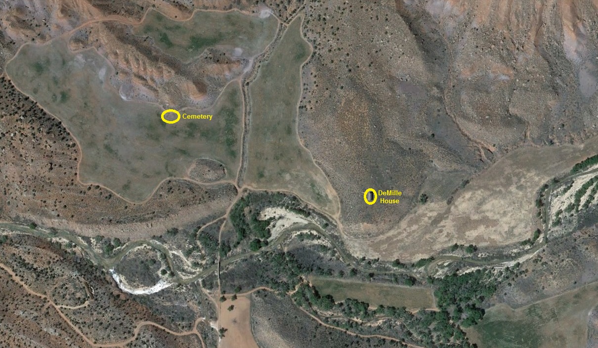
Aerial View of the Area
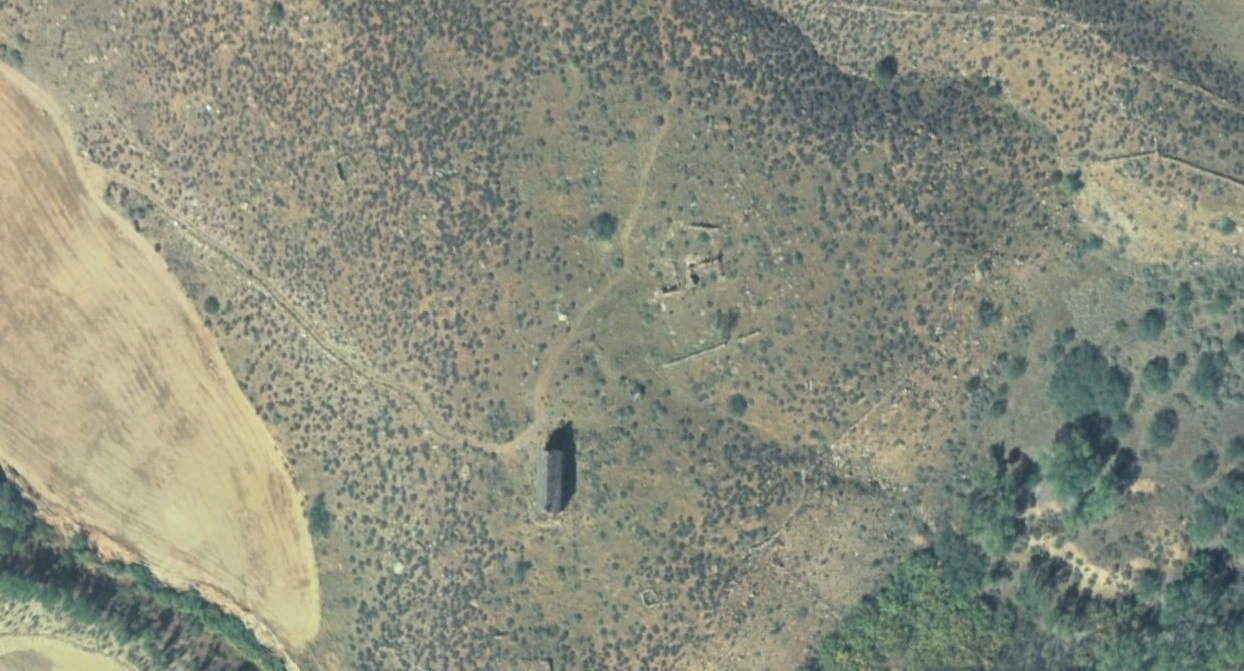
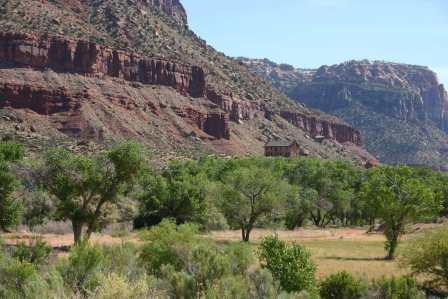
DeMille Rock House and Other Ruins
Other WCHS photos:
WCHS-00463 Photo of rock ruins in Shunesburg
WCHS-00464 Photo of rock ruins in Shunesburg
WCHS-00465 Photo of rock ruins in Shunesburg
WCHS-00466 Photo of rock ruins in Shunesburg
WCHS-00467 Photo of the remains of a rock wall in Shunesburg
WCHS-00468 Photo of a rock wall in the Shunesburg area
WCHS-00469 Photo of a stream in the Shunesburg area
WCHS-04036 Engraving of the mouth of the Virgin River near Shunesburg
REFERENCES
Church History Library, Salt Lake City, Journal History of the Church: IndexShunesburg (also Shonesburg)
1862: Sept 11, page 1
1864: May 8, page 2
July 23, page 1
November 6, page 4
1865: April 20, page 2
May 7, pages 2, 4
October 22, page 4
November 5, page 2
1866: March 15, page 5
May 26, page 1
June 1, page 2
October 5, page 3
December 31, page 1
1868: March 16, page 3
August 17, page 2
October 31, page 3
1870: April 5, page 2
September 10, page 3
December 31, page 2
Shune's Creek
1862: September 25, page 3
Shonesburg
1872: June 9, page 4
1873: December 1, page 2
Shonesburg: The Town Nobody Knows
Article by Janice F. DeMille
Utah Historical Quarterly, Volume 45, Number 1 (Winter 1977)
Pages 47-60
A History of Washington County From Isolation to Destination
Second Edition, 2007
Book by Douglas D. Alder and Karl F. Brooks
Pages 32-33, 75-76, 418
A brief history of Shunesburg by ???
OnlineUtah.com history of Shunesburg
Washington County Chapter, Daughters of the Utah Pioneers, " Under Dixie Sun".
1950 with 1978 Supplement
Page 125-126.
Elephant Butte - Shunesburg Mail Drop History
Researched and written by Dale Brittingham
August 2009
To download, click here.
Southern Utah Memories: Shonesburg lingers on in memory,
by Loren R. Webb, May 31, 2013