
WASHINGTON COUNTY HISTORICAL SOCIETY (Washington County, Utah)
JOHNSON'S TWIST
(aka Johnson Twist, Nephi's Twist)
ROUTE
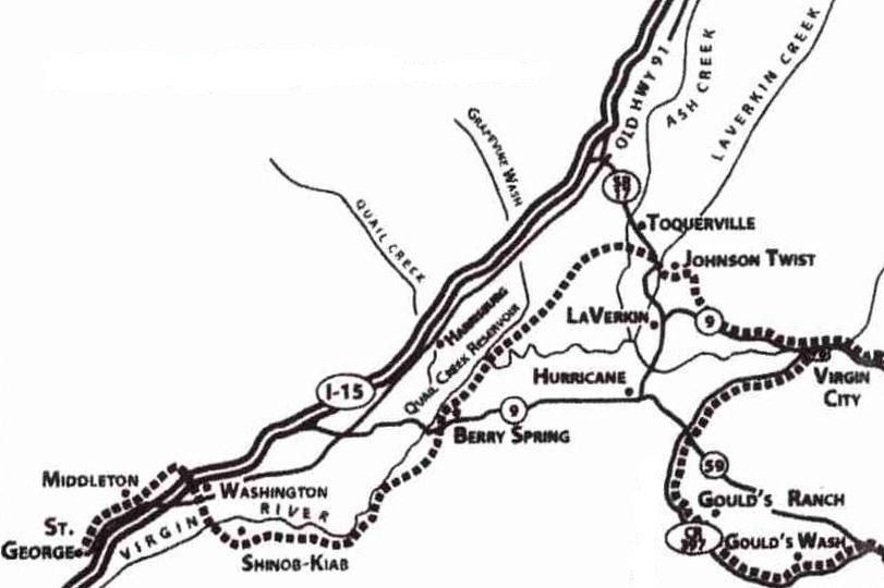
Map by Warren C. Foote
HISTORY
In the September of 1858, Brigham Young ordered a young Mormon missionary by the name of Nephi Johnson to explore for possible settlement the area from newly settled Toquerville up along the East Fork of the Virgin River. Johnson, along with a Paiute guide by the name of Nauguts, went east probably as far as what later became Shunesburg.After returning to Cedar City and reporting his findings, Johnson was sent back to establish a settlement (Pocketville/Virgin) on the Upper Virgin River. He assembled a company and on December 6, 1858, they started building a road a little south and east of Toquerville to go up over the 500 foot high Hurricane Fault. This road became known as Johnson's Twist (aka Johnson Twist and Nephi's Twist). It was used for a long time as the main route east out of Dixie.
PHOTOS
TBDREFERENCES
A Journey Through MukuntuweapBook by David Oswald
Pages 55-56
A History of Washington County from Isolation to Destination
Book by Douglas D. Alder and Karl F. Brooks
Page 30