WASHINGTON COUNTY HISTORICAL SOCIETY (Washington County, Utah)
SHEM DAM AND THE 1955 FLOOD
on the Santa Clara River/Creek
HISTORY
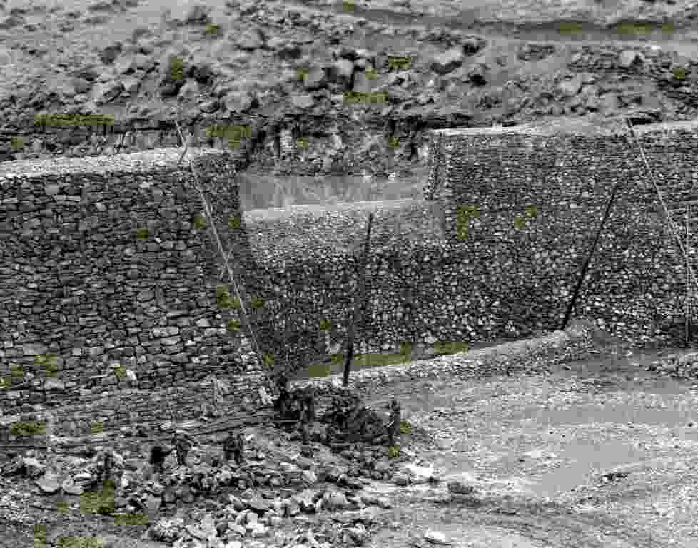
HAER No. UT-96, Pages 11-12Shem Dam was repaired a second time following a heavy flood in 1955, a flood described by Snow as “the largest known in the history of man on the Santa Clara unless it be the flood that came soon after the first white settlers came there.”23 Photographs of the dam taken shortly after the flood show that the damage was more substantial than in 1938 (see Appendix B, Figures 31– 35). Once again the abutments withstood the flood, but the lower, downstream portion of the spillway was badly undercut, and most of the bowl-shaped downstream face of the spillway was carried away, along with nearly all of the interior fill behind it. The upstream wall of the central arch somehow stayed intact, despite the disappearance of most of the structural mass on its downstream side. The secondary crest and apron at the foot of the spillway were also largely carried away. In 1958, Winsor and Snow, probably at the request of the irrigation companies that still relied on the dam for water, collaborated on plans for the repair of the dam. Winsor drew plan and section drawings of the dam, showing the extent of the damage and the proposed repairs, and Snow described the damage and the proposed repairs in a brief report to the irrigation companies.24 Both men were in their 70s. Snow recommended that the downstream apron of the spillway again be rebuilt, this time using large boulders from the streambed below the dam, set in concrete. He also recommended that a deep “cutoff wall” be built at the toe of the apron, extending downward to large boulders in the streambed, presumably to prevent new undercutting. Finally, he recommended widening the spillway crest from its original 70' to 100', which would “distribute the force of the water flowing over the crest over a larger area of the new apron.”25 The drawings by Winsor show that the spillway crest would be widened on the northeast side of the existing spillway, corresponding with the extent of damage to that portion of it (see Appendix A, Figures 8 and 9). Although Snow did not mention it, this would compromise the originally symmetrical appearance of the central arch by rebuilding its damaged upper northeast end not to its original height, 15' above the spillway crest, but only to the original height of the crest. No photographs of the 1958 repair project as it was underway, or of the dam shortly after the repairs were made, were found in research for the current HAER documentation. More-recent photographs of the dam, taken not long before the spillway was again badly damaged in 2011, show that the portion of the spillway repaired in 1958 contrasted sharply in appearance with its intact original portion and with the intact original abutments.26 The basalt boulders used in the 1958 repair, lifted from the bed of the river downstream of the dam, were much larger than any of the quarried rocks visible in the original construction and apparently were used with minimal if any modification. In the 2011 flood, the downstream face of the spillway and the apron were again undercut and partially carried away, exposing the interior of the portion of the spillway repaired in 1958. The large boulders used in the repair evidently took the place both of the original masonry face of the spillway and of the rocky fill behind it.
HAER No. UT-96, Pages 30
The damage sustained by the dam in the 1955 flood was also completely repaired, but the original appearance of the affected portions of the dam, including most of the downstream face of the spillway and the adjacent portion of the northeast abutment, was significantly changed. Rather than rebuild the spillway and the damaged portion of the abutment to their original appearance, the repairs were made in 1958 using large basalt boulders taken from the bed of the river and stacked in place with little or no modification. For the next 53 years, the repaired area looked markedly different from the intact portions of the dam.
PHOTOS
WCHS-03930 Downstream face of the Shem Dam spillway showing the 1955 flood damage
Other WCHS photos:
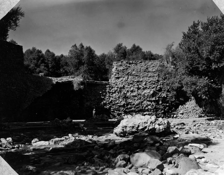
WCHS-03929 Photo of a portion of the downstream face of the Shem Dam spillway, probably showing the 1955 flood damage
WCHS-03931 Photo of the downstream face of the Shem Dam spillway showing the 1955 flood damage
WCHS-03932 Photo of the downstream face of the Shem Dam spillway showing the 1955 flood damage
WCHS-03933 Photo of a portion of the upstream face of Shem Dam showing the 1955 flood damage
REFERENCES
Historic American Engineering Record, Shem Dam (Winsor Dam), HAER No. UT-96Prepared by Scott O'Mack, William Self Associates, Inc.,
for the USDA Natural Resources Conservation Service (NRCS)
March 2016, 96 Pages (see pp. 11-12, 30)
[Large file, so this may take a while to load]