WASHINGTON COUNTY HISTORICAL SOCIETY (Washington County, Utah)
SANTA CLARA HERITAGE SQUARE
Santa Clara, Utah
LOCATION

|
On the north side of Santa Clara Drive
midway between Victor Street and Chapel Street. 37° 7' 58.9" North Latitude, 113° 39' 12.9" West Longitude 37.1330° North Latitude, 113.6536° West Longitude Elevation: 2,762 feet (842 meters) |
FEATURES
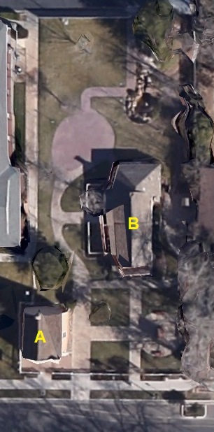
Buildings:A = Santa Clara Relief Society House
B = Hug-Gubler Home
Miscellaneous:
Old School Bell
Signage:
Swiss Colony plaque (DUP, No. 49)
Santa Clara Relief Society House plaque
Santa Clara Relief Society House Historic Site plaque
Hug-Gubler Home plaque
The Settling of Santa Clara plaque
Santa Clara's First Public Buildings plaque
Missionaries and Settlers of Santa Clara Prior to 1861 plaque
Beloved Pioneers plaque
John George Hafen Families plaque
Casper Gubler plaque
History of John and Anna Meier Gubler Family plaque
Hug (Haug) Family plaque
Herman and Selina Gubler plaque
The Rebers plaque
Samuel R. Knight plaque
Wilford Woodruff and Josephine Barbara Baumann Knight plaque
Josephine Barbara Baumann Knight plaque
Samuel Wittwer plaque
Gottlieb and Marianna Hirshi plaque
Jacob Tobler Family plaque
HISTORY
TBDPHOTOS
WCHS photos:WCHS-01818 Photo of the Santa Clara Heritage Square sign
Other photos on the web:
Front of the Santa Clara Heritage Square