WASHINGTON COUNTY HISTORICAL SOCIETY (Washington County, Utah)
DESCRIPTION OF THE SHEM DAM
on the Santa Clara River/Creek
HISTORY
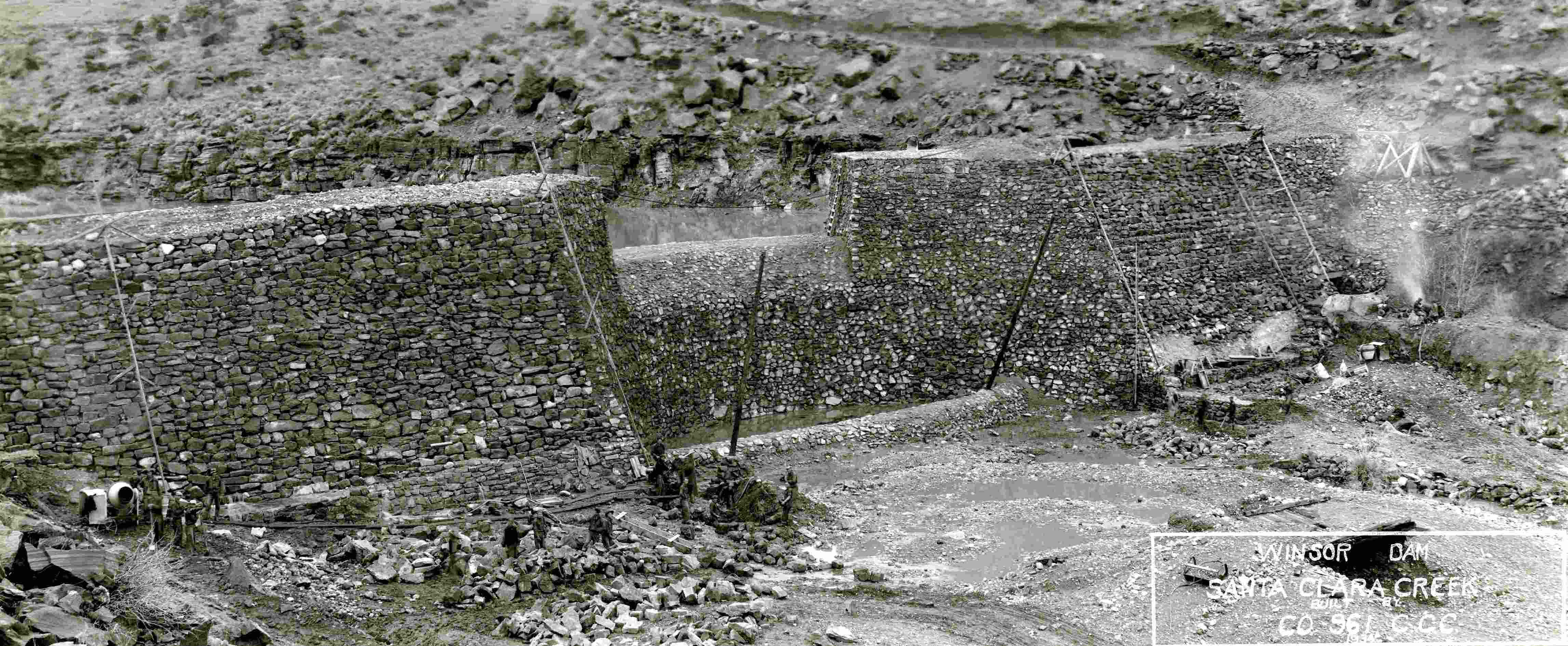
HAER No. UT-96, Pages 7-8A second description of the Shem Dam project was provided by a reporter at the Washington County News about a month before the project was complete. This description is notable for the detail, confirmed in later comments on the dam by Winsor, that the interior fill of the dam consisted of “rock and gravel, the gravel being washed with pumps into the space between the rocks”:
The largest Erosion Control structure in this area is now nearing completion. According to J. C. Tolton, camp superintendent, it will be finished by February 1, 1935.
This structure is a flood control dam on Santa Clara Creek. The dam is of the combined arch and gravity type. It is 100 feet long by eighty-five feet thick at the base and twenty feet thick on top. The spillway is sixty feet wide and twenty-three feet above the bed of the creek. The wall on either side of the spill is fifteen feet high making a total of thirty-eight feet in height. Below the spill is a stilling pool with a baffle wall four feet high; below the stilling pool is a protecting apron which extends twenty-five feet downstream and is three feet thick, built of rock masonry set in concrete mortar.
Both faces of the dam are of rock masonry about four feet thick, with the space between filled with rock and gravel, the gravel being washed with pumps into the space between the rocks. The whole structure contains some 45,000 cubic yards of material. It is located one-half mile above the Shivwits Indian reservation farm. Just below the junction of [an unnamed] wash and Santa Clara creek and just below the point where the waters of Santa Clara creek are diverted into the canal that supplies Ivins and Santa Clara with irrigation water. It was partially completed by the camp last winter; and last summer it did yeoman service in protecting the Santa Clara–Ivins canal from a flood which would have washed out the diversion works and done great damage to irrigation works and crops below.
The dam was designed by L. M. Winsor and Leo A. Snow with [Forest Service] Regional Engineer J. P. Martin as chief consulting engineer. It was designed primarily as a flood control dam and not as an irrigation project, although it does protect previously existing irrigation systems.
“St. George Camp News,” Washington County News, January 10, 1935.
REFERENCES
Historic American Engineering Record, Shem Dam (Winsor Dam), HAER No. UT-96Prepared by Scott O'Mack, William Self Associates, Inc.,
for the USDA Natural Resources Conservation Service (NRCS)
March 2016, 96 Pages (see pp. 7-8)
[Large file, so this may take a while to load]