WASHINGTON COUNTY HISTORICAL SOCIETY (Washington County, Utah)
DESCRIPTION OF THE SHEM DAM
on the Santa Clara River/Creek
HISTORY
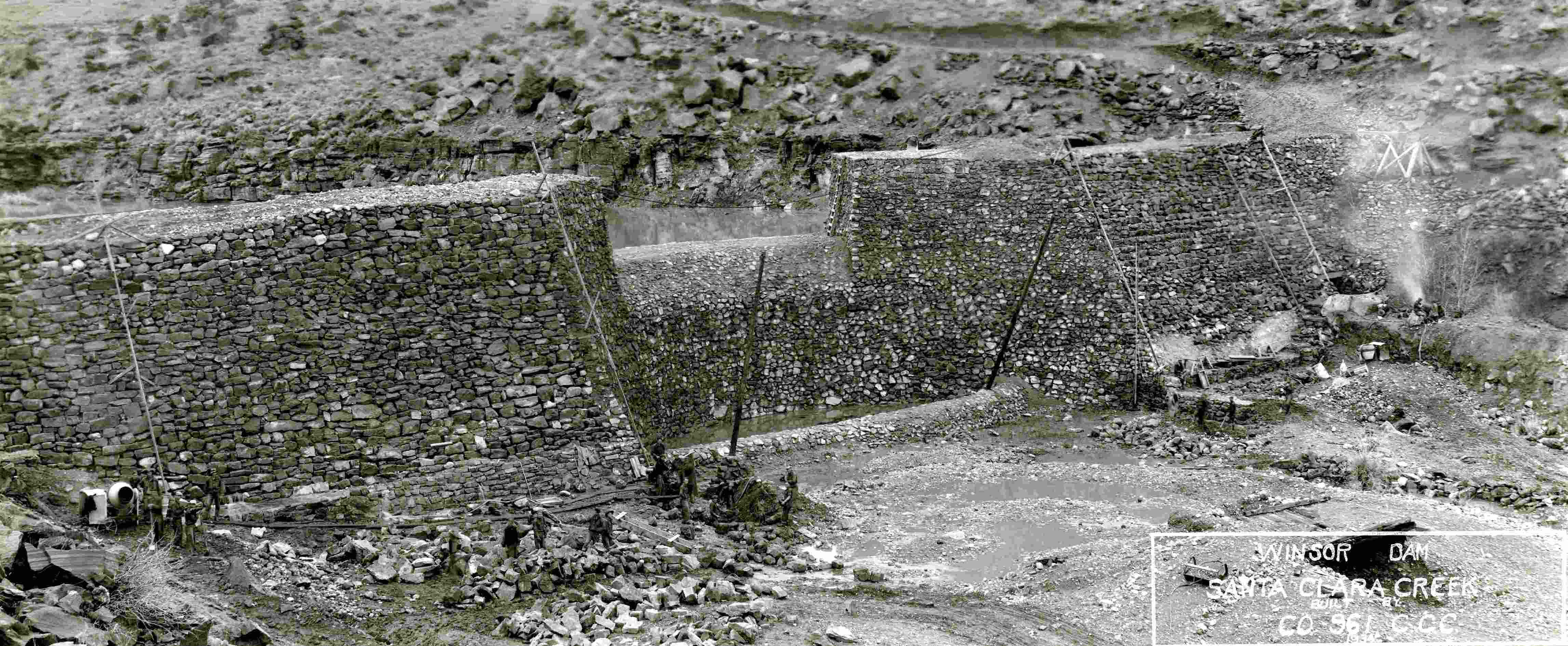
HAER No. UT-96, Pages 6-7The first description was written by the editor of the Washington County News (St. George), who toured the dam site at the start of construction in late January 1934, guided by J. C. Tolton of the Dixie National Forest, who served as superintendent of the St. George CCC camp. This description is most useful for its details on the building of roads to service the project, the drilling and blasting of the adjacent hillsides to obtain rock for the dam, and the building of the cableway to move building materials:
The dam, which is located just below the old copper smelter, is to be 750 feet long at the top, will have a base of 85 feet in width, with an eight foot cut-off wall at the bottom with an eighteen inch [layer of] concrete poured between the rocks. The wing walls are to be ten feet on top and the dam is to be thirty-eight feet above the channel of the stream. The spillway will be constructed of rock and cement and will be fifty feet in width and located twenty-three feet above the channel at about the middle of the dam. Since it is being built as a flood control dam they are constructing it in such a way that the water can seep through and come up lower down the stream. It is possible that this may create new springs and raise the water level in the ground below the dam.
There is to be a tunnel built on the north side of the dam which will take care of the normal flow of the stream. This will be constructed of rock and cement and will be five feet in width and seven feet in height.
Over a mile of road had to be built part of which is for the replacing of the road that followed up the stream and part was road needed in the building of the dam. Considerable blasting had to be done, and much work was encountered in the building of these roads.
Securing of rock for the dam was facilitated by the large quantity of rock on both hill sides of the stream. This rock is being drilled and then dynamited. Twelve ton of concrete was used in building one dead man for the overhead cable. This was tied into a big rock which will add much to its weight. The overhead cable is one and one half inches in diameter, 750 feet in length, will have a sag of twenty feet and will be able to carry up to four tons. This cable will be used to carry all materials used in the dam’s construction after it becomes to[o] high to work on from below.
“Forestry Dept. and CCC Boys Make Progress,” Washington County News, February 1, 1934
REFERENCES
Historic American Engineering Record, Shem Dam (Winsor Dam), HAER No. UT-96Prepared by Scott O'Mack, William Self Associates, Inc.,
for the USDA Natural Resources Conservation Service (NRCS)
March 2016, 96 Pages (see pp. 6-7)
[Large file, so this may take a while to load]