WASHINGTON COUNTY HISTORICAL SOCIETY (Washington County, Utah)
WASHINGTON COUNTY HISTORICAL SOCIETY PHOTO COLLECTION
Photo WCHS-03476
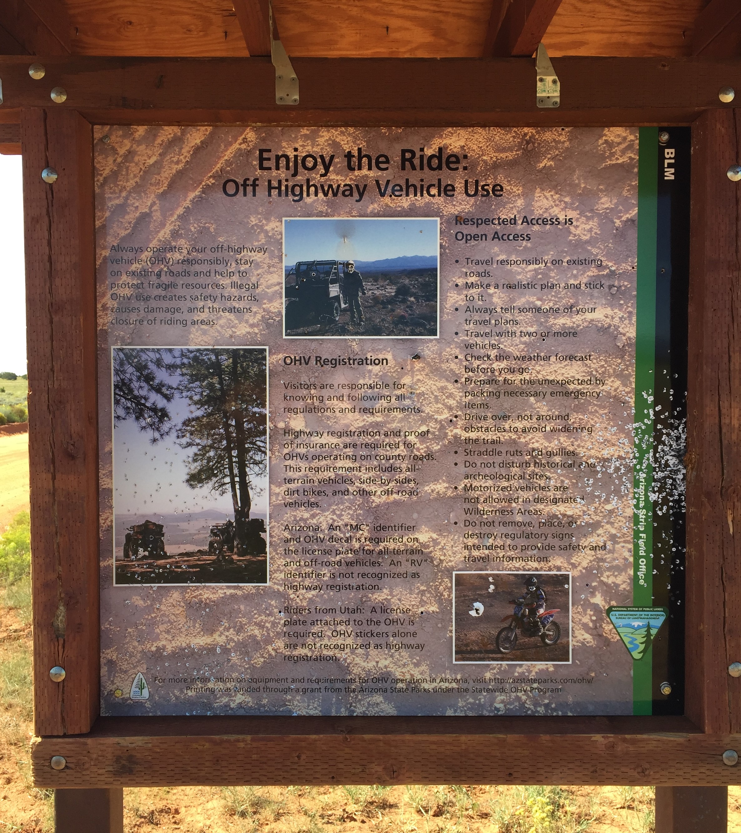
Photo of a roadside sign on Mohave County Road 5 (Mt. Trumbull Loop) on the Arizona Strip.
At the point labeled "A" on the trip map.
Photo taken 8/24/2017 at 10:39 am MDT on a Dixie Arizona Strip Interpretive Association (DASIA) field trip
by George Cannon and contributed by him on 8/25/2017.
The camera is facing southsouthwest and is located at 36° 54' 40.82" North, 113° 1' 7.48" West.