WASHINGTON COUNTY HISTORICAL SOCIETY (Washington County, Utah)
WASHINGTON COUNTY HISTORICAL SOCIETY PHOTO COLLECTION
Photo WCHS-00591

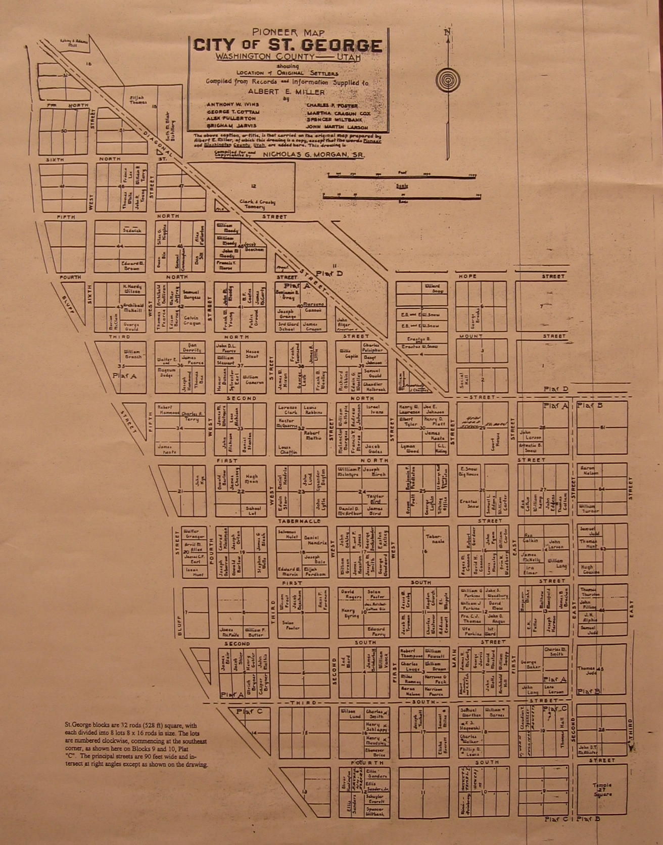
Pioneer map of St. George, Utah.
For a higher resolution JPG version, click here.
For an even higher resolution PDF version, click here.
Contributed by the Washington County Chapter of the Daughters of Utah Pioneers.
The town was laid out in 1862. A basic city block was 32 rods (528 feet) square, with each divided into 8 lots of 8 (132 feet) x 16 (264 feet) rods. The lots were numbered clockwise, commencing at the southeast corner, as shown on Blocks 9 and 10 of Plat C.
The principal streets are 90 feet wide (enough for a team and wagon to turn around).
400 South (aka Parade Street) was 20 feet wider (from ??? to ???) to be used for community parades.