
WASHINGTON COUNTY HISTORICAL SOCIETY (Washington County, Utah)
PINTO, UTAH
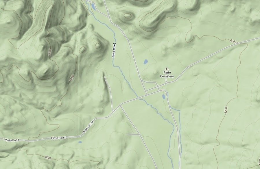
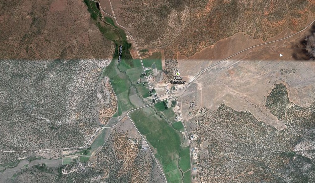
LOCATION
|
37° 32' 16" North Latitude, 113° 30' 59" West Longitude 37.5378° North Latitude, 113.5164° West Longitude Elevation: 6,061 feet (1,848 meters) 12 miles westnorthwest (250°) of New Harmony 11 miles eastsoutheast (77°) of Enterprise 10 miles northeast (35°) for Central Pinto Road is at approximately MM 34 east off of SR 18 |
HISTORY
In the summer of 1864, John Pato, Thales Haskel, and Benjamin Knell settled on a creek which they called Pato Creek. The name soon changed to Pinto Creek which is now the town of Pinto.Pinto, with its lush meadows and clear stream of good water, was a natural stopping place on the Old Spanish Trail. The chief products carried over this trail, before the coming of the Mormons, were Indian slaves and peltries. When the Mormons first arrived in southern Utah they found a well-beaten trail through the streets of Pinto. At the April conference in 1854, President Young called a group of missionaries to the Indians of Southern Utah. Under the leadership of Rufus C. Allen, they commenced operations at Harmony, Utah. About the end of May, the same year, President Young, Heber C. Kimball, Parley P. Pratt and others of the General Authorities, visited there, President Young gave much instruction regarding conducting the mission and building up the settlements in southern Utah. In December 1854, Jacob Hamblin with Ira Hatch, Samuel Knight, Thales Haskell and A.P. Hardy went down the Rio Virgin and settled Santa Clara. In the summer of 1855, Isaac Riddle, Jehu Blackburn and Robert Richey left Harmony and settled Pine Valley. In the fall of 1856, six or eight Indian missionaries camped on Pinto Creek by a hay stack owned by Brother Gould, who, however, was not a permanent settler on the creek, but had come out from Parowan to cut hay. The missionaries, who were in charge of Rufus C. Allen, were on their way from New Harmony to Santa Clara. Benjamin Knell, one of the missionaries writes: "Rufus C. Allen was our president, or captain, and was with us most of the time, trying to get the Indians to come to our camps that we might let them know we were their friends. A few of the older men would come in, but were very shy. From our visit to the Santa Clara we went to Pinto and camped at Gould's hay stack in the summer of 1856. Brothers Dixon, Richard S. Robinson, Amos G. Thornton, Prime T. Coleman and David Wilson Tullis were a part of the company. That year we made our homes on the Pinto Creek hauling hay from the Mountain Meadows for our stock. The winter of 1856-57 was quite mild. Jehu Blackburn and I went on horseback up Pinto Creek to ascertain if we could get a team up the Canyon as he wanted to get into Pine Valley from New Harmony. We found the pass impossible. We drove two yoke of oxen and a heavy wagon on the trail to the head of the middle fork of Pinto creek and then climbed the ridge, getting into Pine Valley that night. Heavy freight teams enroute from Los Angeles, California to Salt Lake City would frequently camp on the Pinto Creek. The mountains were covered with grass. Jacob Hamblin was appointed our captain in a short time and he frequently came to Pinto to give us council. Another account says that a meeting was called in the fall of 1856 by Rufus C. Allen who proposed, on account of the shortage of water, that the settlers at Harmony should take the water out from the Kanarra Creek, and the missionaries take the water from Harmony as this arrangement would give enough water for both parties. John D. Lee was opposed to this plan and the company divided, some going to the Santa Clara and others to Pinto. The following named brethren went to Pinto: Rufus C. Allen (captain), Samuel F. Atwood,Lorenzo W. Roundy, Richard S. Robinson Amos G. Thornton, Prime T. Coleman, Benjamin Knell, Robert Dixon
PHOTOS
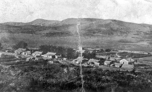
WCHS-03130 Photo of the main street of Pinto in 1875
Other WCHS photos:
WCHS-00093 Photo of the entry arch to the Pinto Cemetery
WCHS-00094 Photo of the entrance to the Pinto Cemetery
WCHS-00095 Photo of the front of a marker at the Pinto Cemetery
WCHS-00096 Photo of the back of a marker at the Pinto Cemetery
WCHS-00097 Photo of an area of graves at the Pinto Cemetery
WCHS-00098 Photo of an area of graves at the Pinto Cemetery
WCHS-00099 Photo of a group of graves at the Pinto Cemetery
WCHS-00100 Photo of a marker at the Pinto Cemetery
WCHS-00101 Photo of an old headstone at the Pinto Cemetery
WCHS-00102 Photo of an old headstone at the Pinto Cemetery
WCHS-00103 Photo of a grave and headstone at the Pinto Cemetery
WCHS-00104 Photo of a headstone at the Pinto Cemetery
WCHS-00105 Photo of a grave with headstone and footstone at the Pinto Cemetery
WCHS-00106 Photo of an internally fenced burial plot at the Pinto Cemetery
WCHS-00107 Photo of an internally fenced burial plot at the Pinto Cemetery
WCHS-00108 Photo of a tall marble marker at the Pinto Cemetery
WCHS-00109 Photo of a tall marble grave marker at the Pinto Cemetery
WCHS-02324 Photo of the DUP "Pinto" monument, Number 204 erected 1954
WCHS-02325 Photo of the DUP "Pinto" monument, Number 204 erected 1954
Other photos on the web:
8/1970 photo of a bench on the porch at the old hotel at Pinto
8/1970 photo of the old hotel at Pinto
7/1960 photo of the meadows along the stream bottom in Pinto Canyon, just south of the town of Pinto
5/1937 photo of three men with horses inspecting deer grazing damage on the range near Pinto
Photo of acting ranger, Wayne Cloward (D-1) checking artificial revegitation near Pinto
Photo of acting ranger, Wayne Cloward (D-1) checking artificial revegitation near Pinto
Photo of plows at a Pinto area reseeding project
1967 photo of a man with a white flag guiding an airplane coming on a reseeding project near Pinto
Photo of PJ type artificial revegitation resulting from a reseeding project near Pinto
Photo of PJ type artificial revegitation resulting from a reseeding project near Pinto
Photo of along road from Pinto to Iron Mountain - artificial revegetation, Pinto reseeding project, denuded PJ type
10/11/1967 photo of "chaining" to remove pinyon juniper trees near Pinto
8/19/1911 photo of Pinto Creek showing wash which was once a road and a meadow
1913 photo of an unidentified man standing in Pinto Creek wash
10/1/2006 photo of Pinto Road on the Northern end of the Pine Valley Mountains
10/1/2006 photo of some rocks near Kane Point on Pinto Road in the Pine Valley Mountains
10/1/2006 photo of a rock (Kane Point?) seen from Pinto Road
10/1/2006 photo of the Pine Valley Mountains viewed from Pinto Road
10/1/2006 photo of a view from the Pinto Road (probably of the town of Pinto)
10/1/2006 photo an old barn seen from Pinto Road
10/1/2006 photo of some abandoned buildings along the Pinto Road on the Northern end of the Pine Valley Mountains
10/1/2006 photo of an abandoned home in Pinto
10/1/2006 photo of the Pine Valley Mountains viewed from the Pinto Road near Pinto
REFERENCES
History of Pinto, Utahby Rulon Knell
Library of Congress, Manuscript Division, WPA Federal Writers' Project Collection
History of Pinto, Utah
by John W. Van Cott on OnlineUtah.com
Pinto, Utah Ghost Town
from St. George Online
Washington County Chapter, Daughters of the Utah Pioneers, " Under Dixie Sun".
1950 with 1978 Supplement.
Pages 125, 213-218, Supplement Pages 22-23.
Southern Utah Memories: Pinto, Utah was a popular stop along the Old Spanish Trail,
by Loren R. Webb, August 6, 2013
Pinto Town and Family Histories
Blog by by Rulon Knell
Pinto or Pato - Historians Split Over Town's Name
Short paragraph about the names Pato and Pinto
Sons of Utah Pioneers Hear of Ghost Towns
Pinto Field Trip Notes
Handout at the 7/15/2023 WCHS Field Trip
By Richard R. Kohler, July 14, 2023