
WASHINGTON COUNTY HISTORICAL SOCIETY (Washington County, Utah)
THE DOMINGUEZ-ESCALANTE TRAIL
(1776 Expedition)
ROUTE
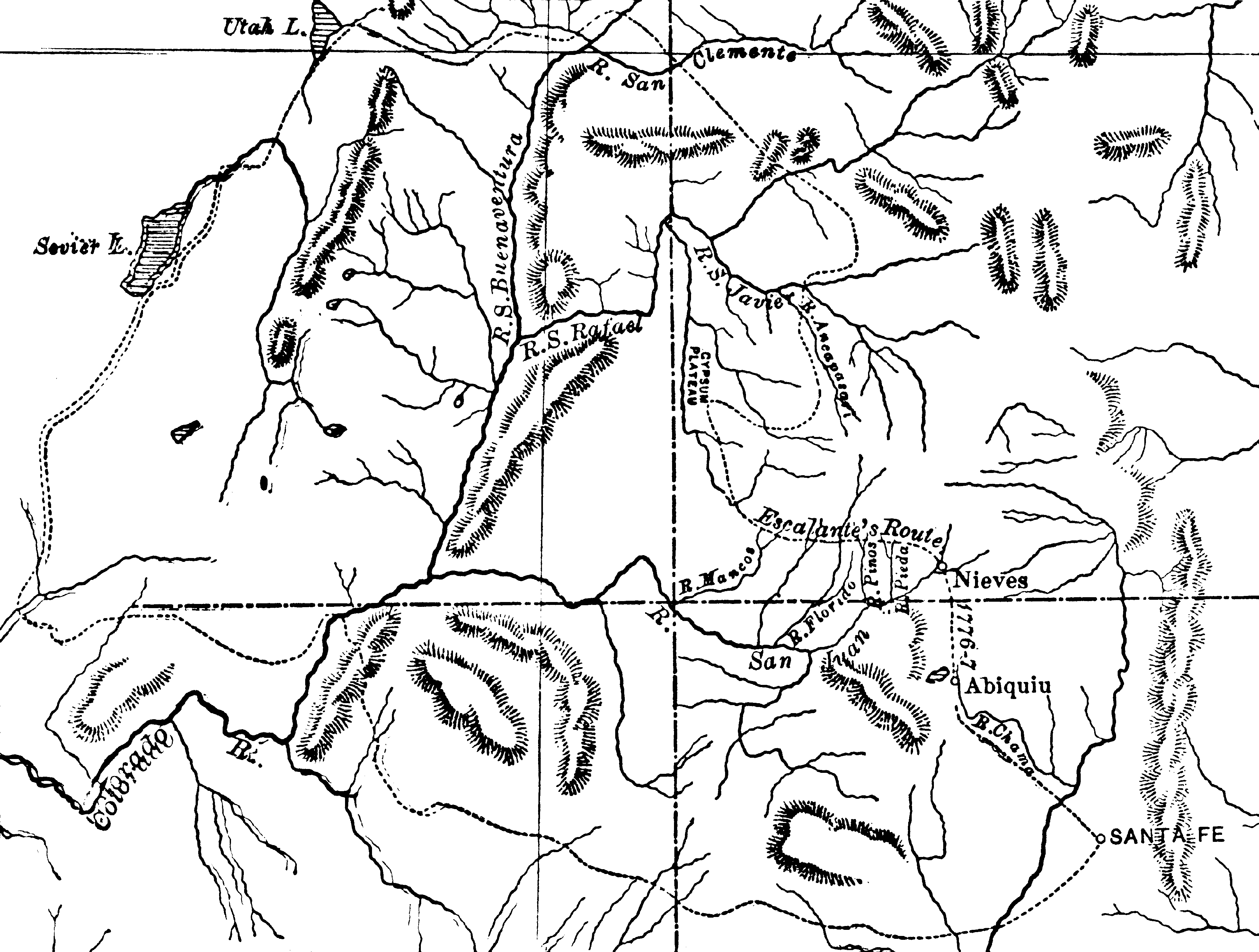
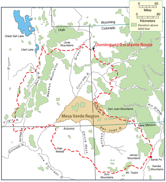
Santa Fe (July 29)
Western Colorado
Crossed the Utah border near the present-day quarry in Dinosaur National Monument (September 12)
Crossed the Green River and ascended the Duchesne and Strawberry Rivers
Passed from the Uinta Basin into the drainage of Diamond Fork
Descended to the Spanish Fork River
Nearing Utah Valley, they left the river bank to climb a high prominence near the present-day Spanish Oaks Golf Course
Utah Valley (September 24)
Pahvant Valley
Pahvant Butte
Clear Lake Waterfowl Refuge
Milford (October 5)
Cedar City
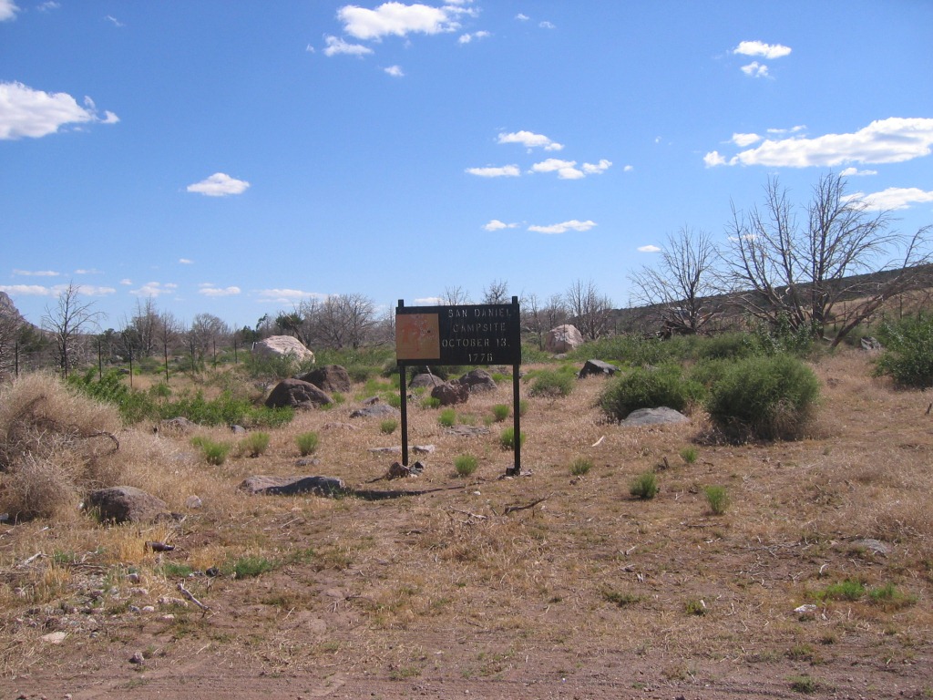
San Daniel Camp (October 13)
Hurricane
Padre Bay
Oraibi
Santa Fe (January 2)
HISTORY
They left Santa Fe on July 29, 1776.Expedition members included:
Father Francisco Atanasio Dominguez
Father Silvestre Velez de Escalante
Bernado Miera y Pachecho (a retired military engineer)
Don Juan Pedro Cisneros (the chief administrative officer of Zuni)
Andres Muniz (had accompanied Rivera on a 1775 expedition and was fluent in the Ute language)
Silvestre (a Timpanogot Indian guide)
Joaquin (a Timpanogot Indian guide)
Jose Maria (a Timpanogot Indian guide)
???
???
???
???
???
???
On October 5, 1776, they were caught by a heavy snowstorm just north of where Milford is now.
Between Milford and Cedar City there was a disagreement among the expedition members about whether to return home or push on. They "left it up to God" by drawing straws and so the decision was made to return to Santa Fe.
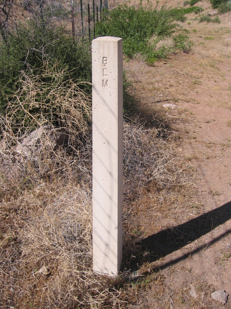
On October 13, 1776, they camped at the San Daniel campsite, where Exit 33 of I-15 is now.
They arrived back in Santa Fe on January 2, 1777, after a journey of more than 1,700 miles.
PHOTOS
|
|
The above three photos, WCHS-00156, WCHS-00158, and WCHS-00159 are from the Dominguez-Escalante San Daniel Campsite at I-15 Exit 33.
Other WCHS photos:
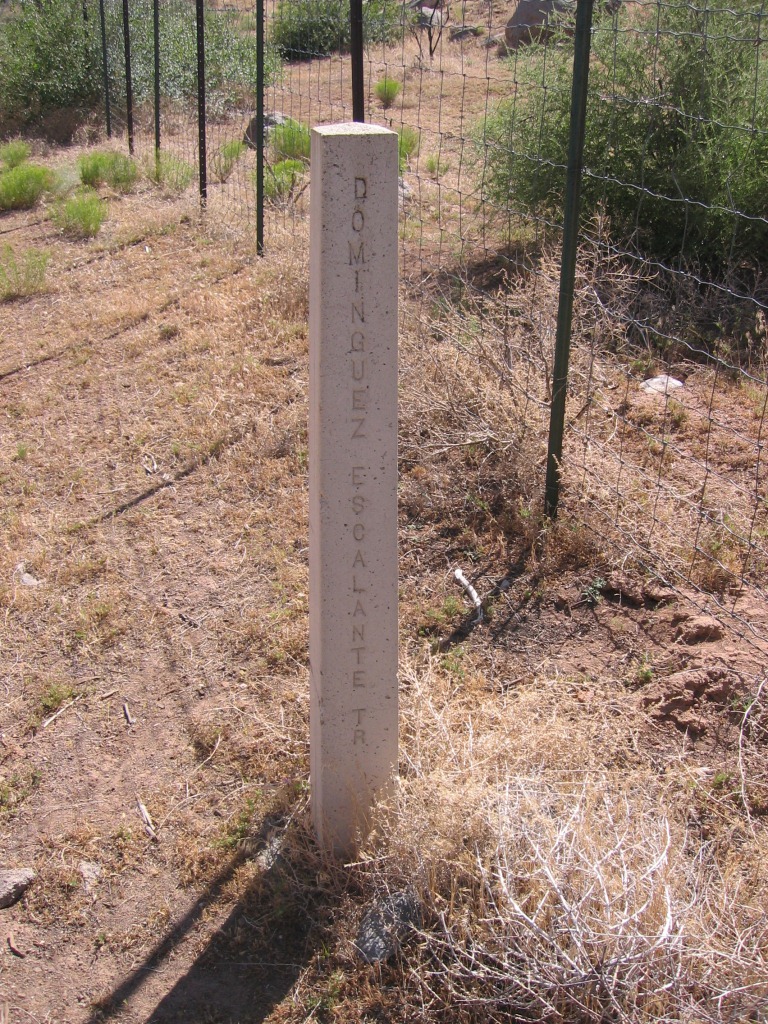
WCHS-00157 Photo of the Dominguez-Escalante San Daniel Campsite Sign at I-15 Exit 33
REFERENCES
Utah History to Go article about the Dominguez-Escalante ExpeditionSuite101.com article about the Dominguez-Escalante Expedition
Utah History to Go article about The Crossing of the Fathers
Diary of Dominguez & Escalante and related notes
Teaching materials for the Dominguez & Escalante Expedition
Wikipedia article about Francisco Atanasio Dominguez
Wikipedia article about Silvestre Velez de Escalante
Maps drawn by Escalante at the Library of Congress
"The Route of the Dominguez-Escalante Expedition, 1775-77: A Report of Trail Research
Conducted Under the Auspices of the Dominguez-Escalante State/Federal Bicentennial Committee
and the Four Corners Regional Commission"
Book by David E. Miller
210 Pages, 1976
This research report maps out the route of Fray Francisco Atanasio Dominguez's remarkable 1776 expedition
through the Rocky Mountains, the eastern Great Basin, and the Colorado Plateau, examining the terrain
and likely stops along the route, accompanied by photographs and maps.
"The Dominguez Escalante Journal: Their Expedition Through Colorado Utah Azrizona and New Mexico in 1776"
by Ted J. Warner
Paperback book
"Virgin Water: Below the Confluence"
by Richard Kohler
Page 16.
To view, click here