WASHINGTON COUNTY HISTORICAL SOCIETY (Washington County, Utah)
AVIATION NAVIGATION ARROWS
Washington County, Utah
LOCATIONS
Black Ridge (Beacon 40A)1.25 miles southwest (239°) from I-15 Exit 36
37° 23' 45.18" North Latitude, 113° 15' 26.31" West Longitude
37.395884° North Latitude, 113.257308° West Longitude
5,054 feet (1,540 meters) MSL
Arrow is pointing 19.5° from true north
Click for View 1 Click for View 2 Click for View 3 Click for View 4 Click for View 5
Pintura (Beacon 39B)
Unknown if there was an arrow here
Leeds (Beacon 39)
Unknown if there was an arrow here.
??? (Beacon 38)
Unknown if there was an arrow here
Quail Creek Reservoir West Overlook (Beacon 37C)
On the bluff westnorthwest of the Quail Creek Water Treatment Plant
37° 10' 50.11" North Latitude, 113° 24' 1.57" West Longitude
37.180587° North Latitude, 113.400437° West Longitude
3,603 feet (1,098 meters) MSL
Arrow is pointing 50.4° from true north
Click for View 1 Click for View 2 Click for View 3 Click for View 4
Shinob Kibe (Beacon 37B or HO0622) (LOS ANGELES SALT LK AWY BN 37B)
On the very south edge of the Shinob Kibe mesa
37° 7' 2.80" North Latitude, 113° 29' 15.51" West Longitude
37.117448° North Latitude, 113.487639° West Longitude
3,303 feet (1,007 meters) MSL
Arrow is pointing 54.8° from true north
Click for View 1 Click for View 2 Click for View 3
Bloomington Overlook (Beacon 37A)
On the bluff west of the Bloomington Wal-Mart; on the south side of the water tank
37° 3' 53.37" North Latitude, 113° 35' 43.32" West Longitude
37.064826° North Latitude, 113.595366° West Longitude
2,932 feet (894 meters) MSL
Arrow is pointing 61.3° from true north
Click for View 1 Click for View 2
HISTORY
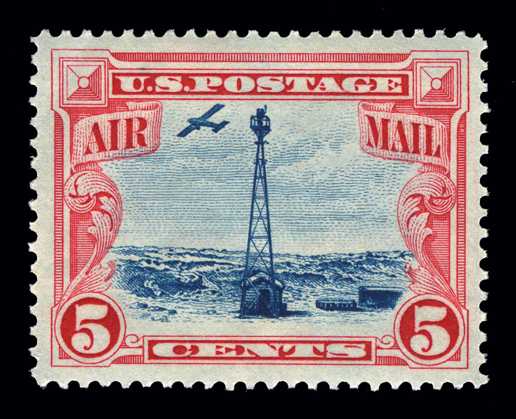
On August 20, 1920, the United States opened its first coast-to-coast airmail delivery route, just 60 years after the Pony Express closed up shop.There were no good aviation charts in those days, so pilots had to eyeball their way across the country using landmarks. This meant that flying in bad weather was difficult, and night flying was just about impossible.
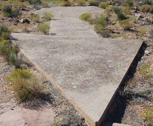
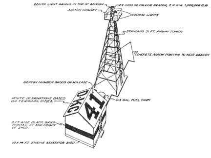
The Postal Service solved the problem with the world's first ground-based civilian navigation system: a series of lighted beacons that would extend from New York to San Francisco. Every ten miles, pilots would pass a 70-foot concrete arrow on the ground which was painted a bright yellow. At the center of each arrow there would be a 51-foot steel tower and topped by a million-candlepower rotating beacon. Below the rotating light were two course lights pointing forward and backward along the arrow. The course lights flashed a code to identify the beacon's number. If needed, a generator shed at the tail (or feather end) of each arrow powered the beacon and lights.
By 1924, just a year after Congress funded it, the line of giant concrete markers stretched from Rock Springs, Wyoming to Cleveland, Ohio. The next summer, it reached all the way to New York and then extended all the way to San Francisco by 1929.
Around 1926, the new Aeronautics Branch in the Department of Commerce (or U.S. Postal Service?) proposed a 650-mile air mail route linking Los Angeles to Salt Lake City and passing through Washington County. It was designated as Contract Air Mail Route 4 (CAM-4). Western Air Express, Inc. was awarded a contract to lay out the route and carry the mail. Their first flight was made on April 17, 1926 in a Douglas M-2 airplane. By 1928, the route had been marked with the cement arrows and beacon towers for navigation at night and in inclement weather.
New advances in communication and navigation technology made the big arrows obsolete, and the Commerce Department decommissioned the beacons in the 1940s. The steel towers were torn down and went to the war effort. Today, only some of the weathered cement arrows (less the yellow paint) remain.
PHOTOS
|
 |
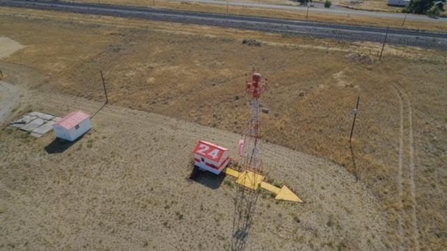
WCHS-03829 Restored navigation arrow and station at Dubois, Idaho
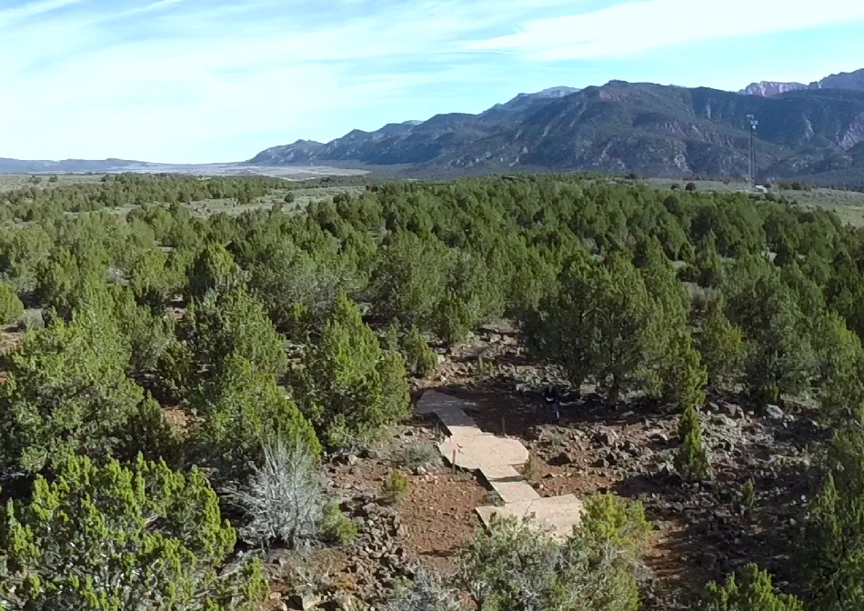
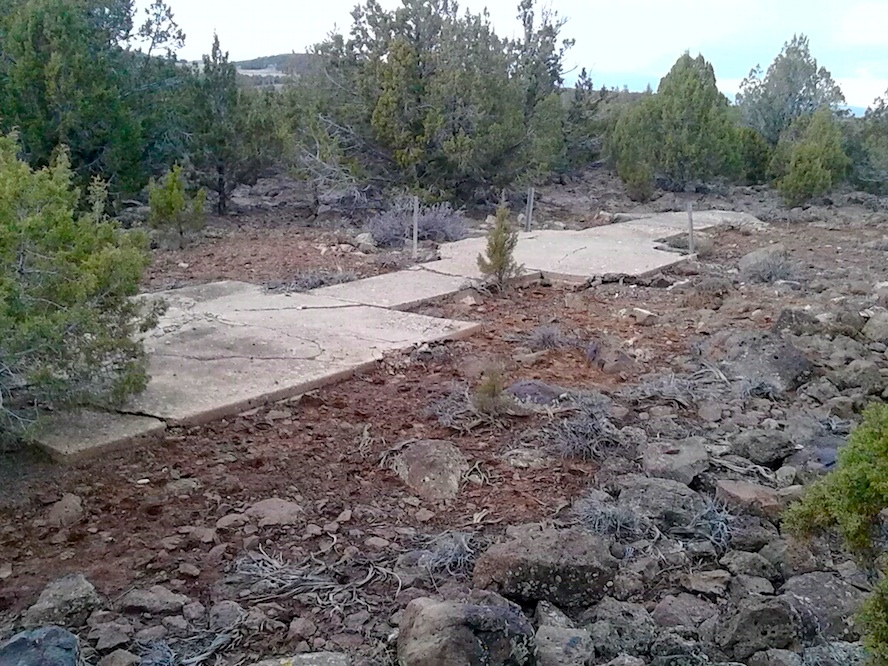
 Head of the Quail Creek Reservoir West Overlook arrow looking northeast |
 Head of the Quail Creek Reservoir West Overlook arrow looking southwest |
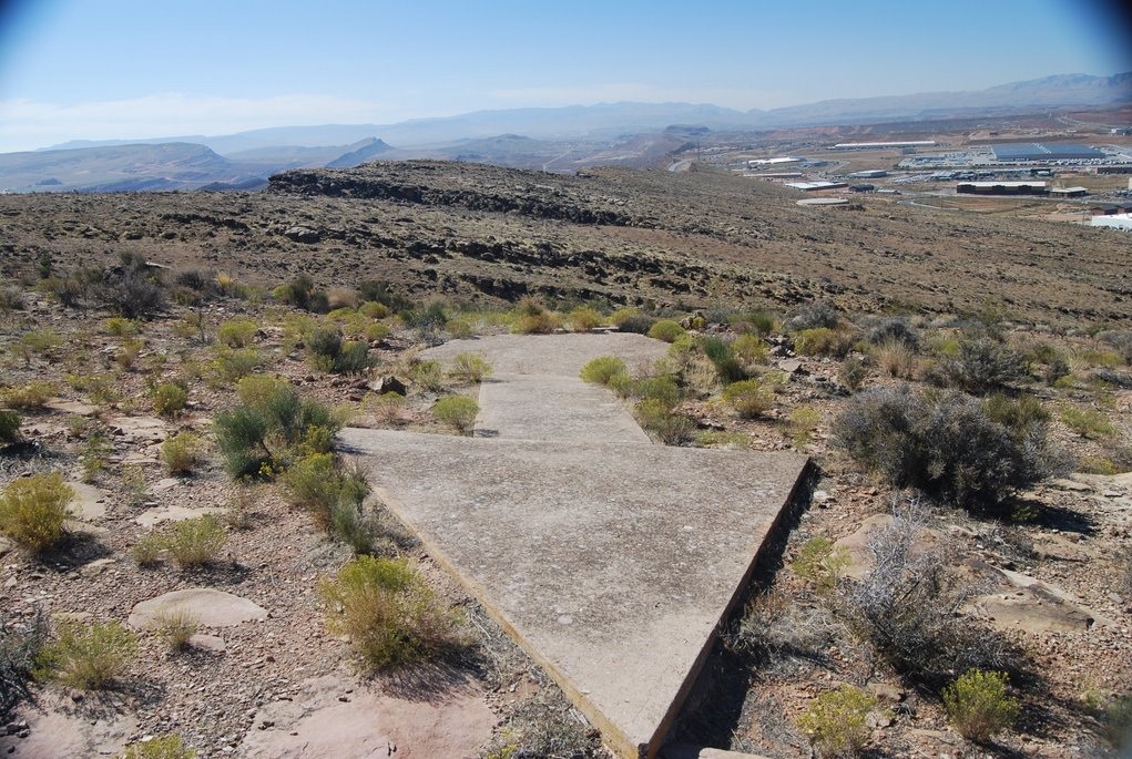
 WCHS-02648 Black Ridge arrow looking northnortheast |
 WCHS-02647 Black Ridge arrow looking northnorthwest |
Other WCHS photos:
WCHS-03827 Photo of a remaining aviation navigation site (Monida MT) from the late 1920s and early 1930s
WCHS-03828 Photo of a remaining aviation navigation site (Monida MT) from the late 1920s and early 1930s
WCHS-03830 Photo of a remaining aviation navigation site (Dubois ID) from the late 1920s and early 1930s
REFERENCES
A brief history of the Federal Aviation AdministrationFAA article on the building of the airways
Aaron D. Gifford's article on Concrete Arrows in Southwestern Utah
Images of Faith: A Pictorial History of St. George, Utah
By Lynne Clark, 2012
Page 338
Lights to Be Established in the Vicinity of St. George
Washington County News, September 13, 1928, Page 1
CAM Contract Air Mail First Flights CAM-4
Airway Map No. 133, November 1930, Las Vegas NV to Milford UT
Airway Beacons List - Western U.S.
Interactive Map of U.S. Airway Beacons
Wikipedia article on Airway Beacons
The Forgotten Giant Arrows that Guide you Across America
by MessyNessy
In The Desert: Arrows
by Don & Linda Gilmore
Washington County points the way from Salt Lake to L.A., 1920s navigational cement arrows
by John Teas, St. George News, September 7, 2013
No Filter: Historic aviation arrows land So. Utah in National Geographic
by No Filter Show, St. George News, April 22, 2015