WASHINGTON COUNTY HISTORICAL SOCIETY (Washington County, Utah)
WASHINGTON COUNTY HISTORICAL SOCIETY PHOTO COLLECTION
Photo WCHS-02525
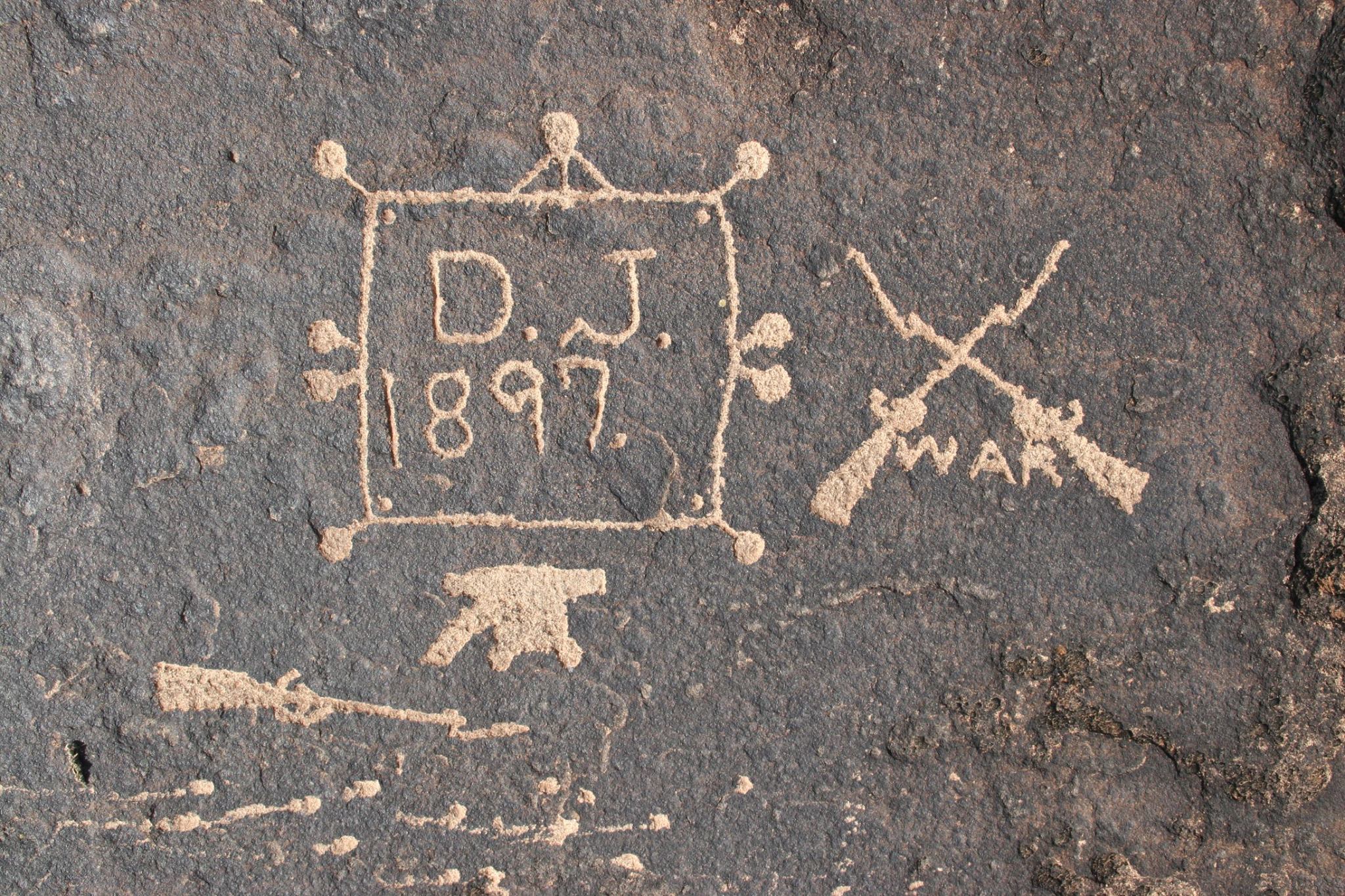
Many years ago Glen Martin discovered this 1897 pioneer petroglyph on the cliff over looking the back boundary
of Bloomington. It depicts several symbols of war. He assumes that this petroglyph refers to the Spanish
American war. Local vandals have since put their own petroglyph close to the site of this one.
Glen provided this update on 1/30/2017:
After I had posted this picture with you, I started to deciphor what its meaning was. In doing so, this pictures tells
us that it is a survey marker done by a surveyor with the initials of D.J. in the year of 1897.
At first, I thought it was from the Spanish-American War, but after looking at the weapons, it was better decided
that it depicted the Civil War. The canon on the bottom of this picture is located on the North, which indicated to
me that it represented the Civil War. It is of a survey section measuring one mile square. It also shows the
quarter corners each measuring a half of a mile.
The number of canon balls surrounding the square perimeter made me think that this was section number nine,
but that proved not to be true. The canon also needed to be added up with the balls which made this section
number ten.
I gained much satisfaction in discovering the meaning behind this important photo.
Photo taken by Glen E. Martin and contributed by him on 11/22/2014.